Wednesday 23 January 2013

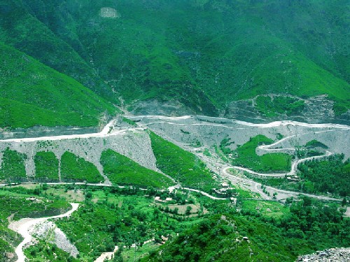
Awesome Murree

Awesome Murree
Murree was developed in 1851 by the (then) President of the Punjab Administrative Board, Sir Henry Lawrence,[3] and was originally established for the British troops garrisoned on the Afghan frontier[4] as a sanatorium.[5] Officially, the municipality was created in 1850.[6]
The permanent town of Murree was constructed at Sunnybank in 1853. The church was sanctified in May 1857, and the main road, Jinnah Road, formerly known as The Mall (and still commonly referred to as), was built. The most significant commercial establishments, the Post Office, general merchants with European goods, tailors and a millinery, were established opposite the church. Until 1947, access to Jinnah Road was restricted for "natives" (non-Europeans).
Until 1876, Murree was the summer headquarters of the Punjab local government; after 1876 the headquarters were moved to Shimla.
The railway connection with Lahore, the capital of the Punjab Province, via Rawalpindi, made Murree a popular resort for Punjab officials, and the villas and other houses erected for the accommodation of English families gave it a European aspect. The houses crowned the summit and sides of an irregular ridge, the neighbouring hills were covered during the summer with encampments of British troops, while the station itself was filled with European visitors from the plains and travellers to Kashmir.
In the hot season it was the headquarters of the Lieutenant General of the Northern Command. The Commissioner of the Rawalpindi Division and the Deputy-Commissioner of Rawalpindi also resided here during part of the hot season, for which period an Assistant Commissioner was placed in charge of the subdivision consisting of Murree Tehsil. The site was selected in 1850 almost immediately after the annexation of the Province, and building operations commenced at once. In 1851 temporary accommodation was provided for a detachment of troops; and in 1853 permanent barracks were erected. The regular garrison generally consisted of two mountain batteries and one battalion of infantry. In 1873, 1874, and 1875 Murree was the summer headquarters of the Punjab Government. It was connected with Rawalpindi town by a service of tongas.


Awesome Karachi

Awesome Karachi
The area of Karachi (Urdu: تاريخ کراچی‎), in Sindh, Pakistan was known to the ancient Greeks by many names: Krokola, where Alexander the Great camped in Sindh to prepare a fleet for Babylonia after his campaign in the Indus valley; 'Morontobara' port (probably the modern Manora Island near the Karachi harbor), from where Alexander's admiral Nearchus sailed for back home; and Barbarikon, a sea port of the Indo-Greek Bactrian kingdom. Karachi was called Ramya in some Greek texts[1]. The Arabs knew it as the port of Debal, from where Muhammad Bin Qasim led his conquering force into Sindh (the western corner of South Asia) in AD 712. According to the British historian Eliot, parts of district of Karachi and the island of Manora constituted the city of Debal.[citation needed] Lahari Bandar or Lari Bandar succeeded Debal as a 
major port of the Indus[2] it was located close to Bhambore, in modern Karachi.
According to legend, the city started as a fishing settlement, where a fisherwoman, Mai Kolachi, settled and started a family. The village that grew out of this settlement was known as Kolachi-jo-Goth (The Village of Kolachi in Sindhi). When Sindh started trading across the sea with Muscat and the Persian Gulf in the late 18th century, Karachi gained in importance; a small fort was constructed for its protection with a few cannons imported from Muscat. The fort had two main gateways: one facing the sea, known as Khara Dar (Brackish Gate) and the other facing the adjoining Lyari river, known as the Meetha Dar (Sweet Gate). The location of these gates corresponds to the present-day city localities of Khaaradar (Khārā Dar) and Meethadar (Mīṭhā Dar) respectively.

Awesome Islamabad

Awesome Islamabad
The city of Islamabad, the capital of Pakistan, is located on the Pothohar Plateau within the Islamabad Capital Territory and is regarded to be one of the earliest sites of human settlement in Asia.[1] Some of the earliest Stone Age artifacts in the world have been found on the plateau, dating from 100,000 to 500,000 years ago. The crude stones recovered from the terraces of the Soan River testify to the endeavours of early man in the inter-glacial period.[2] Items of pottery and utensils dating back to prehistory have been found.[3]
Excavations have revealed evidence of a prehistoric culture. Relics and human skulls have been found dating back to 5000 BC that show this region was home to Neolithic people who settled on the banks of the Swaan River.[1] The Neolithic people developed small communities in the region at around 3000 BC.[2][4] Situated at one end of the Indus Valley Civilization, the area was the first habitation of the Aryan community in Central Asia
List of people from Islamabad Punjabis Muhajirs Pashtuns Islam Hinduism Christianity Politics Aiwan-e-Sadr Parliament of Pakistan Supreme Court of Pakistan Faisal Mosque Fatima Jinnah Park Islamabad Zoo Golra Sharif Daman-e-Koh Pakistan Museum of Natural History Lok Virsa Museum.
Educational institutes Air University Al-Huda University Allama Iqbal Open University Bahria University Center for Advanced Studies in Engineering COMSATS Institute of Information Technology Federal Urdu University Hamdard University International Islamic University Muhammad Ali Jinnah University National Defence University Foundation University.

Awesome Kashmir

Awesome Kashmir
According to folk etymology, the name "Kashmir" means "desiccated land" (from the Sanskrit: Ka = water and shimeera = desiccate). In the Rajatarangini, a history of Kashmir written by Kalhana in the mid-12th century, it is stated that the valley of Kashmir was formerly a lake. According to Hindu mythology, the lake was drained by the great rishi or sage, Kashyapa, son of Marichi, son of Brahma, by cutting the gap in the hills at Baramulla (Varaha-mula). When Kashmir had been drained, Kashyapa asked Brahmans to settle there. ground for the story which has taken this form. The name of Kashyapa is by history and tradition connected . Cashmere is an archaic spelling of Kashmir, and in some countries it is still spelled this way.
According to legend, Jammu was founded by Raja Jamboolochan in the 14th century BC. During one of his hunting campaigns he reached the Tawi River where he saw a goat and a lion drinking water at the same place. The king was impressed and decided to set up a town after his name, Jamboo. With the passage of time, the name was corrupted and became "Jammu"
Kashmir was one of the major centre of Sanskrit scholars.
According to the Mahabharata,[3] the Kambojas ruled Kashmir during the epic period with a Republican system of government[4] from the capital city of Karna-Rajapuram-gatva-Kambojah-nirjitastava.,[5][6] shortened to Rajapura,[7][8][9][10] which has been identified with modern Rajauri.[11] Later, the Panchalas are stated to have established their sway. The name Peer Panjal, which is a part of modern Kashmir, is a witness to this fact. Panjal is simply a distorted form of the Sanskritic tribal term Panchala. The Muslims prefixed the word peer to it in memory of Siddha Faqir and the name thereafter is said to have changed into Peer Panjal.[12] The Mauryan emperor Ashoka is often credited with having founded the city of Srinagar.

Awesome Malakand

Awesome Malakand
The Malakand Agency was one of the Tribal Areas in the Khyber Pakhtunkhwa of Pakistan until 1970. It included the princely states of Chitral, Dir and Swat, and an area around the Malakand Fort known as the Malakand Protected Area.
In 1970, following the abolition of the princely states, the agency became the Malakand Division, which was divided into districts, one of which was the Malakand Protected Area, known as Malakand District. In the year 2000 the Malakand Division was abolished.
Despite the constitutional changes since 1970, the expression Malakand Agency is still used, sometimes of the entire area of the former Agency, but more often of Malakand District.
Before 1970 the area was a Tribal Area known as the Malakand Protected Area, part of the Malakand Agency.
In 1970 it became Malakand District, a Provincially Administered Tribal Area, until 2000 part of Malakand Division. Malakand agency lies at a strategically important position as it acts as a Gateway to Swat, Dir, Chitral and Bajaur. It is surrounded by a series of mountains that were overgrown with different kinds of trees in the past though they have a barren look today. The famous Malakand Pass which connects Mardan to Swat and Dir is located near Dargai, where the local Pushtun tribes fought two fierce battles with the British army in 1895 and 1897.
The Swat River flows through it down towards Charsadda District where it falls into the Kabul River. Malakand Agency is bounded on the north by Lower Dir District, on the East by Swat District, on the south east and south west by Mardan and Charsadda districts respectively and on the west by Mohmand and Bajour Agencies. The area of Malakand protected area is 952 km2. Malakand Agency is divided into two sub-division, Swat Ranizai and Sam Ranizai. Malakand is the head quarter of Malakand Agency. 

Awesome Lahore

Awesome Lahore
The recorded history of Lahore (Urdu: تاريخ لاہور‎), the second largest city-district of Pakistan, covers thousands of years. Originally the capital and largest city of the Punjab region, it has since its creation changed hands from Hindu, Buddhist, Greek, Afghan, Muslim, Sikh and British rule to becoming the cultural capital and the heart of modern day Pakistan
A mythological legend, based on oral traditions, states that Lahore was named after Lava, son of the Hindu god Rama, who supposedly founded the city. To this day, the Lahore Fort has a vacant temple dedicated to Lava (also pronounced Loh, hence "Loh-awar" or The Fort of Loh). Likewise, the Ravi River that flows through northern Lahore was named for the Hindu goddess Durga.[1]
Ptolemy, the celebrated astronomer and geographer, mentions in his Geographia a city called Labokla[2] situated on the route between the Indus river and Palibothra or Pataliputra (Patna), in a tract of country called Kasperia (Kashmir), described as extending along the rivers Bidastes or Vitasta (Jhelum), Sandabal or Chandra Bhaga (Chenab), and Adris or Iravati (Ravi).
Moreover, some of the oldest and most sacred Hindu shrines are found within this locality, namely Bhairo ka sthain and the Chandrat. The gate of the present city, known as the Lahori or Lohari Gate was so called as being the gateway looking in the direction of Lohawar or old Lahore just as the Kashmiri Gate looks towards Kashmir, and the Delhi Gate of modern Delhi to the ancient city of that name.[6]
There are no architectural remains of the old Hindu city of Lahore, a circumstance which might well be explained by the absence of stone material, and the numerous destructive invasions to which the city has been subjected.

Awesome Faisalabad

Awesome Faisalabad
Faisalabad, (Urdu: فيصل آباد‎) formerly known as Lyallpur, is the third largest metropolis in Pakistan, the second largest in the province of Punjab after Lahore, and a major industrial center in the heart of Pakistan. The city was established in 1880.
Nicknamed the Manchester of Asia, Faisalabad remains an important industrial city west of Lahore. The city-district of Faisalabad is bound on the north by the districts of Hafizabad and Chiniot, on the east by Nankana Sahib, on the south by Sahiwal, and Toba Tek Singh and on the west by Jhang.
The city is at a road and railway junction, which has played an influential role in the development of Faisalabad's trade and economy. The surrounding countryside, irrigated by the Lower Chenab River, has seen expanded production of cotton, wheat, sugarcane, vegetables, and fruits, which form 55% of Pakistan's exports.